Related Posts
Why chase solar eclipses?
 Why I chase total solar eclipse all over the world
Why I chase total solar eclipse all over the world
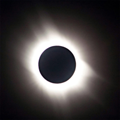
2015 Solar Eclipse - Spitzbergen / Faroe Islands
About the Total Solar Eclipse in 2015 in the Faroe Islands and Spitzbergen
About the Total Solar Eclipse in 2015 in the Faroe Islands and Spitzbergen
2015 Solar Eclipse - orthographic map
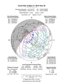 Orthographic map of the 2015 Total Solar Eclipse
Orthographic map of the 2015 Total Solar Eclipse
Wiltshire - Stonehenge
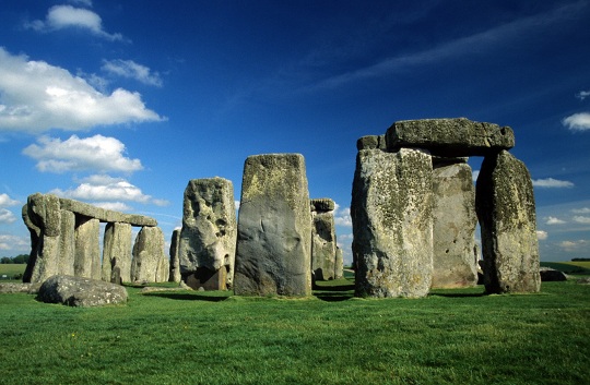 UNESCO-listed Stonehenge monoliths in Wiltshire
UNESCO-listed Stonehenge monoliths in Wiltshire
Wiltshire - Salisbury Cathedral
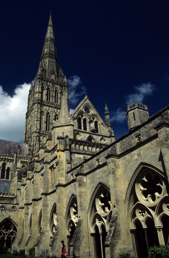 Spire at Salisbury Cathedral in Wiltshire
Spire at Salisbury Cathedral in Wiltshire
Prague, Stockholm and Copenhagen - recommended hotels
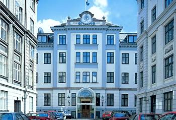 Recommended hotels in Prague, Stockholm and Copenhagen
Recommended hotels in Prague, Stockholm and Copenhagen
Windsor - Diamond Jubilee Military pageant
 Pageant through historic Windsor to commerate the Diamond Jubilee of Queen Elizabeth II
Pageant through historic Windsor to commerate the Diamond Jubilee of Queen Elizabeth II
Windsor - Diamond Jubilee Military pageant
 Pageant through historic Windsor to commerate the Diamond Jubilee of Queen Elizabeth II
Pageant through historic Windsor to commerate the Diamond Jubilee of Queen Elizabeth II